
Month: December 2016
Sean Hannity Exposes Hillary
Editor’s note: Not a fan of FOX News. Not a fan of either political party. But I do appreciate it when someone in the media nails the Truth.
WE FOUND IT ! Sean Hannity EXPOSING Hillary Clinton & Barack Obama !!!!!
Mother OBLITERATES Common Core in 4 Minutes
Editor’s note: Children are flunking. Stats show U.S., under Common Core, the U.S. now ranks 31st out of 35 Industrialized Nations for math and similar results for science and reading. We owe our kids the truth. We owe our kids the right to learn in an environment that is most concerned with their love of learning and their ability TO learn – at the individual level – free from government bureaucracy.
Arkansas Mother Obliterates Common Core in 4 Minutes!
Heliplots Update for 12/19/16 – 10:
Heliplots
These data update automatically every 30 minutes
Last update: December 20, 2016 06:02:31 UTC
Seismograms may take several moments to load. Click on a plot to see larger image.
-
CU/ANWB Willy Bob, Antigua and Barbuda 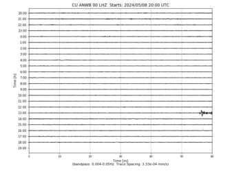
-
CU/BBGH Gun Hill, Barbados 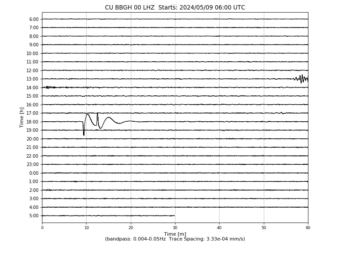
-
CU/BCIP Isla Barro Colorado, Panama 
-
CU/GRGR Grenville, Grenada 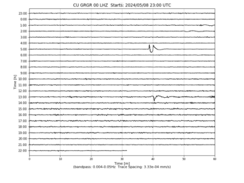
-
CU/GRTK Grand Turk, Turks and Caicos Islands 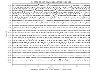
-
CU/GTBY Guantanamo Bay, Cuba 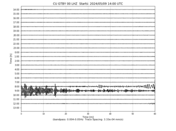
-
CU/MTDJ Mount Denham, Jamaica 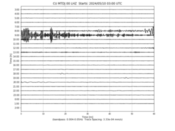
-
CU/SDDR Presa de Sabenta, Dominican Republic 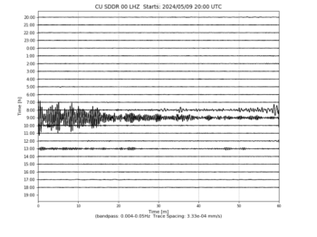
-
CU/TGUH Tegucigalpa, Honduras 
-
IC/BJT Baijiatuan, Beijing, China 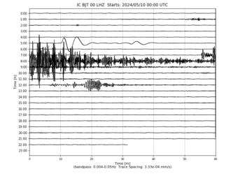
-
IC/ENH Enshi, Hubei Province, China 
-
IC/HIA Hailar, Neimenggu Autonomous Region, China 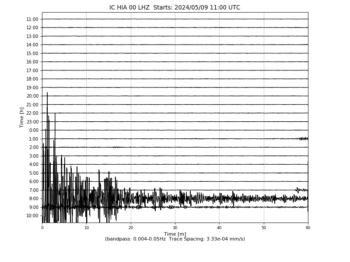
-
IC/KMI Kunming, Yunnan Province, China 
-
IC/LSA Tibet, China 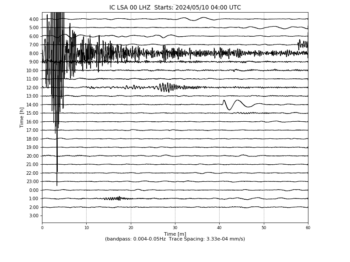
-
IC/MDJ Mudanjiang, Heilongjiang Province, China 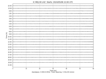
-
IC/QIZ Qiongzhong, Hainan Province, China 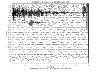
-
IC/SSE Shanghai, China 
-
IC/WMQ Urumqi, Xinjiang Province, China 
-
IC/XAN Xi’an, China 
-
IU/ADK Adak, Aleutian Islands, Alaska 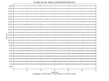
-
IU/AFI Afiamalu, Samoa 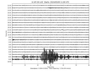
-
IU/ANMO Albuquerque, New Mexico, USA 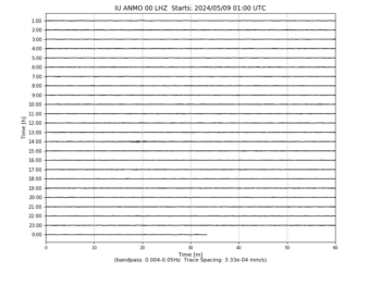
-
IU/ANTO Ankara, Turkey 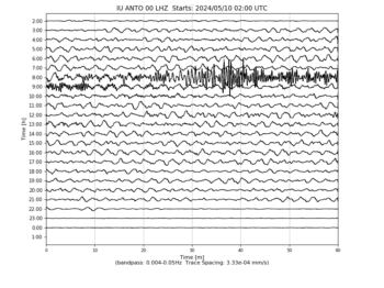
-
IU/BBSR Bermuda Institute of Ocean Sciences, St George’s Bermuda 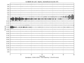
-
IU/BILL Bilibino, Russia 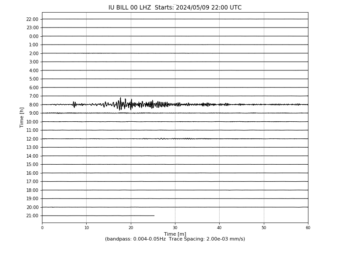
-
IU/CASY Casey, Antarctica 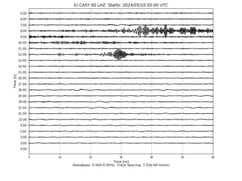
-
IU/CCM Cathedral Cave, Missouri, USA 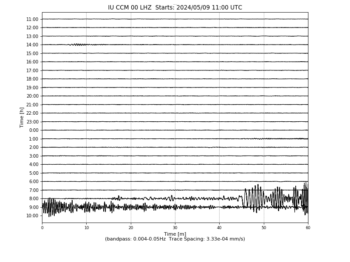
-
IU/CHTO Chiang Mai, Thailand 
-
IU/COLA College Outpost, Alaska, USA 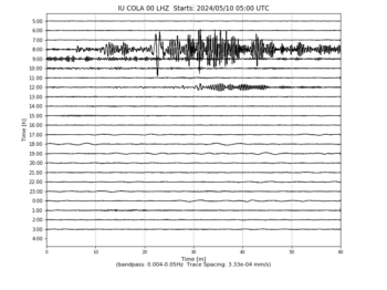
-
IU/COR Corvallis, Oregon, USA 
-
IU/CTAO Charters Towers, Australia 
-
IU/DAV Davao, Philippines 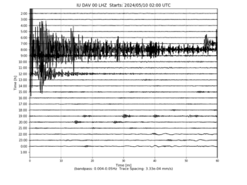
-
IU/DWPF Disney Wilderness Preserve, Florida, USA 
-
IU/FUNA Funafuti, Tuvalu 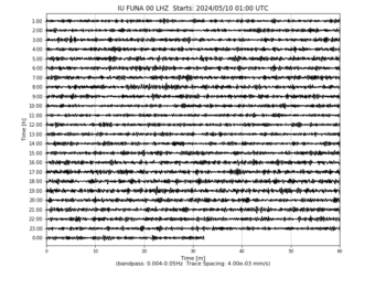
-
IU/FURI Mt. Furi, Ethiopia 
-
IU/GNI Garni, Armenia 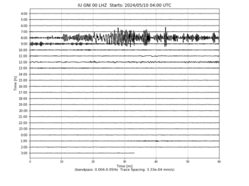
-
IU/GRFO Grafenberg, Germany 
-
IU/GUMO Guam, Mariana Islands 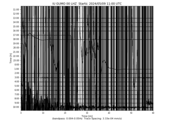
-
IU/HKT Hockley, Texas 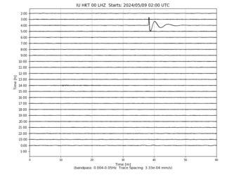
-
IU/HNR Honiara, Solomon Islands 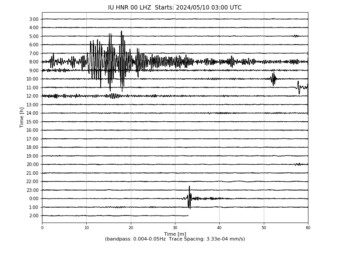
-
IU/HRV Adam Dziewonski Observatory (Oak Ridge), Massachusetts, USA 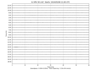
-
IU/INCN Inchon, Republic of Korea 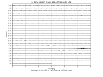
-
IU/JOHN Johnston Island, USA 
-
IU/KBL Kabul, Afghanistan 
-
IU/KBS Ny-Alesund, Spitzbergen, Norway 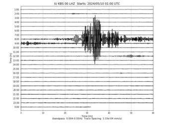
-
IU/KEV Kevo, Finland 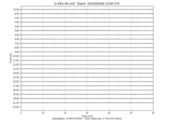
-
IU/KIEV Kiev, Ukraine 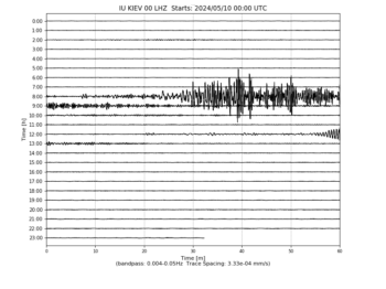
-
IU/KIP Kipapa, Hawaii, USA 
-
IU/KMBO Kilima Mbogo, Kenya 
-
IU/KNTN Kanton, Kiritibati 
-
IU/KONO Kongsberg, Norway 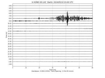
-
IU/KOWA Kowa, Mali 
-
IU/LCO Las Campanas Astronomical Observatory, Chile 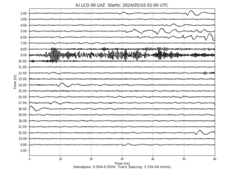
-
IU/LSZ Lusaka, Zambia 
-
IU/LVC Limon Verde, Chile 
-
IU/MA2 Magadan, Russia 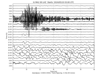
-
IU/MACI Morro de la Arena, Canary Islands 
-
IU/MAJO Matsushiro, Japan 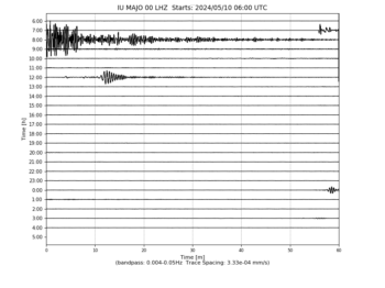
-
IU/MAKZ Makanchi, Kazakhstan 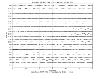
-
IU/MBWA Marble Bar, Western Australia 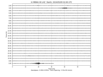
-
IU/MIDW Midway Island, USA 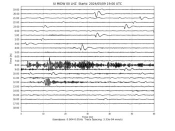
-
IU/MSKU Masuku, Gabon 
-
IU/NWAO Narrogin, Australia 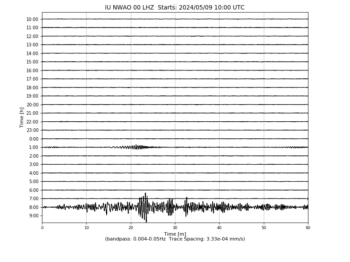
-
IU/OTAV Otavalo, Ecuador 
-
IU/PAB San Pablo, Spain 
-
IU/PAYG Puerto Ayora, Galapagos Islands 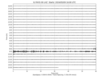
-
IU/PET Petropavlovsk, Russia 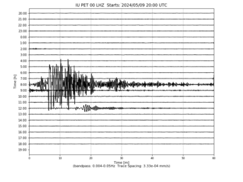
-
IU/PMG Port Moresby, New Guinea 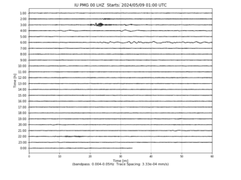
-
IU/PMSA Palmer Station, Antarctica 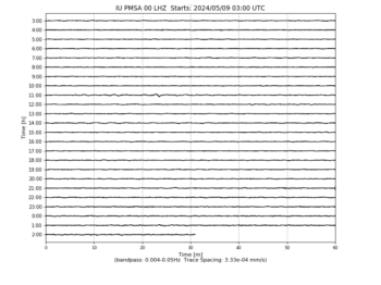
-
IU/POHA Pohakuloa, Hawaii, USA 
-
IU/PTCN Pitcairn Island, South Pacific 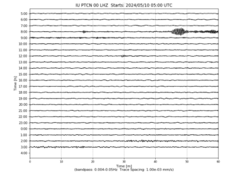
-
IU/PTGA Pitinga, Brazil 
-
IU/QSPA South Pole Remote Earth Science Observatory (Quiet Zone) 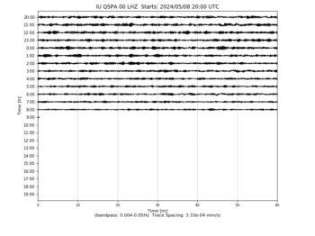
-
IU/RAO Raoul, Kermadec Islands 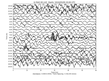
-
IU/RAR Rarotonga, Cook Islands 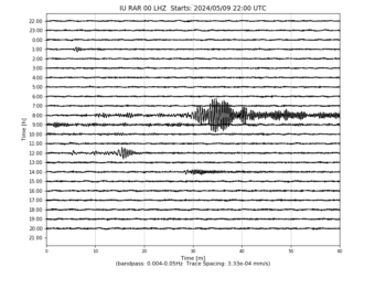
-
IU/RCBR Riachuelo, Brazil 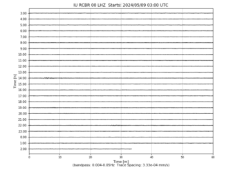
-
IU/RSSD Black Hills, South Dakota, USA 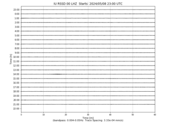
-
IU/SAML Samuel, Brazil 
-
IU/SBA Scott Base, Antarctica 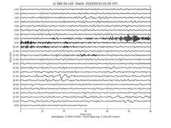
-
IU/SDV Santo Domingo, Venezuela 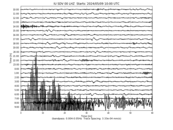
-
IU/SFJD Sondre Stromfjord, Greenland 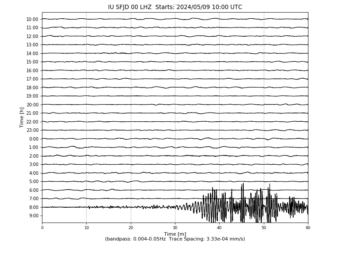
-
IU/SJG San Juan, Puerto Rico 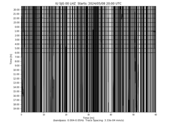
-
IU/SLBS Sierra la Laguna Baja California Sur, Mexico 
-
IU/SNZO South Karori, New Zealand 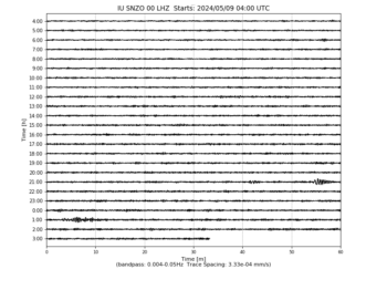
-
IU/SSPA Standing Stone, Pennsylvania 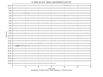
-
IU/TARA Tarawa Island, Republic of Kiribati 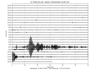
-
IU/TATO Taipei, Taiwan 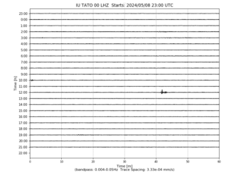
-
IU/TEIG Tepich, Yucatan, Mexico 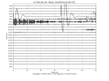
-
IU/TIXI Tiksi, Russia 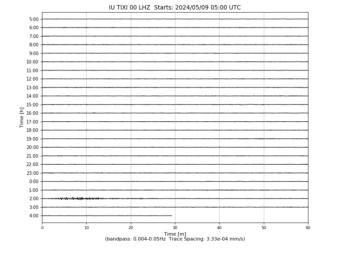
-
IU/TRIS Tristan da Cunha 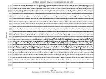
-
IU/TRQA Tornquist, Argentina 
-
IU/TSUM Tsumeb, Namibia 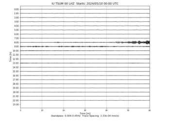
-
IU/TUC Tucson, Arizona 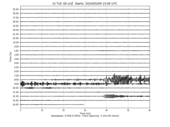
-
IU/ULN Ulaanbaatar, Mongolia 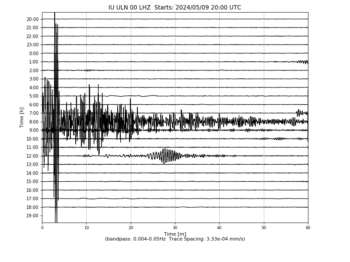
-
IU/WAKE Wake Island 
-
IU/WCI Wyandotte Cave, Indiana, USA 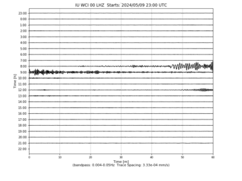
-
IU/WVT Waverly, Tennessee, USA 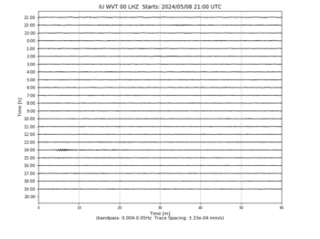
-
IU/XMAS Kiritimati Island, Republic of Kiribati 
-
IU/YAK Yakutsk, Russia 
-
IU/YSS Yuzhno Sakhalinsk, Russia 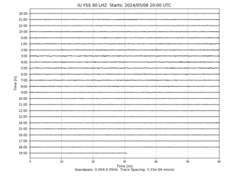
-
US/AAM Ann Arbor, Michigan, USA 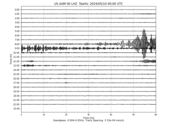
-
US/ACSO Alum Creek State Park, Ohio, USA 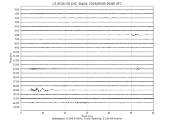
-
US/AGMN Agassiz National Wildlife Refuge, Minnesota, USA 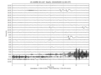
-
US/AHID Auburn Hatchery, Idaho, USA 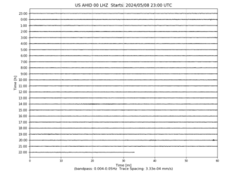
-
US/AMTX Amarillo, Texas, USA 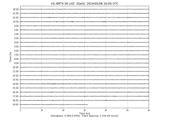
-
US/BINY Binghamton, New York, USA 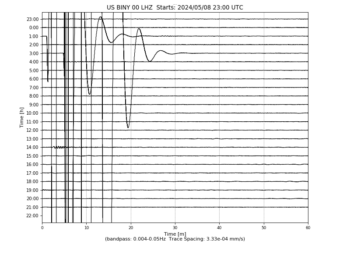
-
US/BLA Blacksburg, Virginia, USA 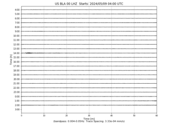
-
US/BMO Blue Mountains Array (Baker), Oregon, USA 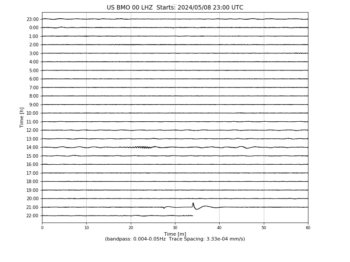
-
US/BOZ Bozeman, Montana, USA 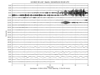
-
US/BRAL Brewton, Alabama, USA 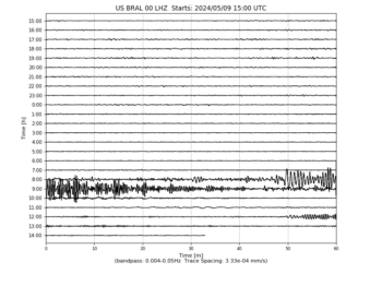
-
US/BW06 Boulder Array Site 6 (Pinedale Array Site 6), Wyoming, USA 
-
US/CBKS Cedar Bluff, Kansas, USA 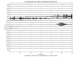
-
US/CBN Corbin (Fredericksburg Observatory), Virginia, USA 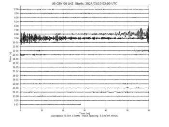
-
US/CNNC Cliffs of the Neuse, North Carolina, USA 
-
US/COWI Conover, Wisconsin, USA 
-
US/DGMT Dagmar, Montana, USA 
-
US/DUG Dugway, Tooele County, Utah, USA 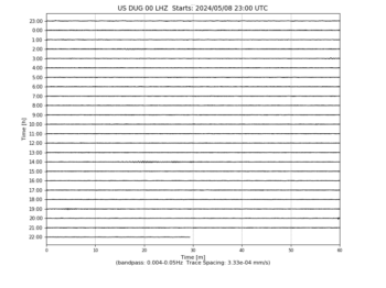
-
US/ECSD EROS Data Center, Sioux Falls, South Dakota, USA 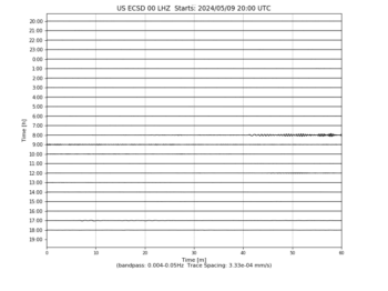
-
US/EGAK Eagle, Central Alaska, Alaska, USA 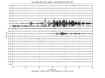
-
US/EGMT Eagleton, Montana, USA 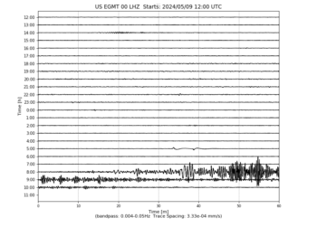
-
US/ELK Elko, Nevada, USA 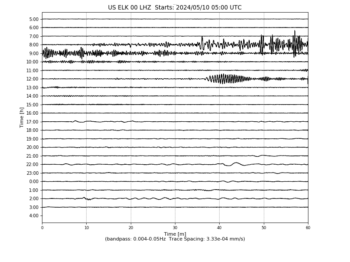
-
US/ERPA Erie, Pennsylvania, USA 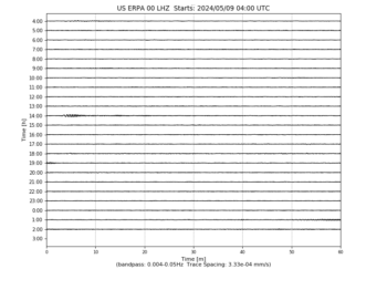
-
US/EYMN Ely, Minnesota, USA 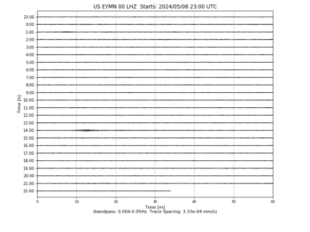
-
US/GLMI Grayling, Michigan, USA 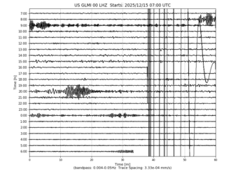
-
US/GOGA Godfrey, Georgia, USA 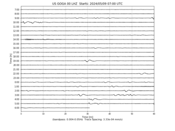
-
US/HAWA Hanford, Washington, USA 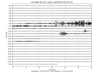
-
US/HDIL Hopedale, Illinois, USA 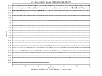
-
US/HLID Hailey, Idaho, USA 
-
US/HWUT Hardware Ranch, Cache County, Utah, USA 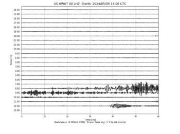
-
US/ISCO Idaho Springs, Colorado, USA 
-
US/JCT Junction, Texas, USA 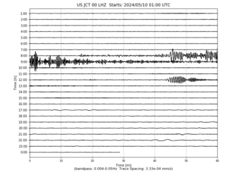
-
US/JFWS Jewell Farm, Wisconsin, USA 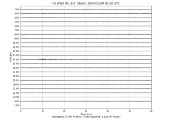
-
US/KSU1 Kansas State University–Konza Prairie, Kansas, USA 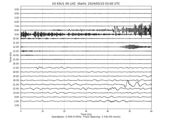
-
US/KVTX Kingsville, Texas, USA 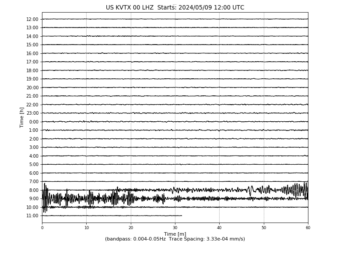
-
US/LAO LASA Array, Montana, USA 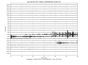
-
US/LBNH Lisbon, New Hampshire, USA 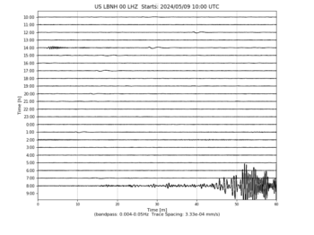
-
US/LKWY Lake (Yellowstone–Lake), Yellowstone National Park, Wyoming 
-
US/LONY Lake Ozonia, New York, USA 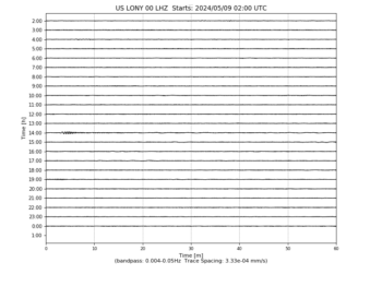
-
US/LRAL Lakeview Retreat, Alabama, USA 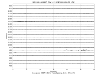
-
US/MCWV Mont Chateau, West Virginia, USA 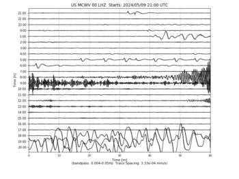
-
US/MIAR Mount Ida, Arkansas, USA 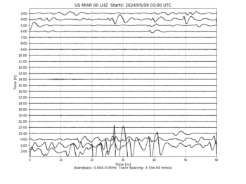
-
US/MNTX Cornudas Mountains, Texas, USA 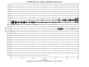
-
US/MSO Missoula, Montana, USA 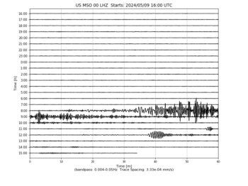
-
US/MVCO Mesa Verde, Colorado, USA 
-
US/NATX Nacogdoches, Texas, USA 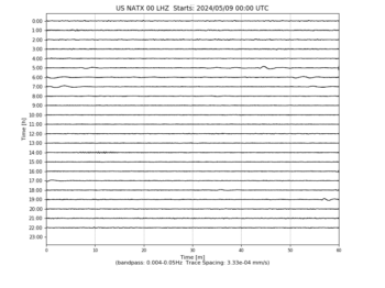
-
US/NEW Newport, Washington, USA 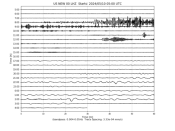
-
US/NHSC New Hope, South Carolina, USA 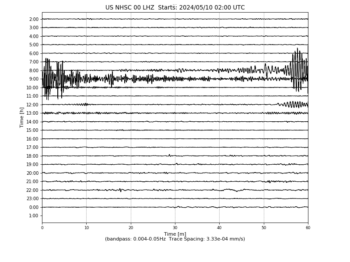
-
US/NLWA Neilton Lookout, Washington, USA 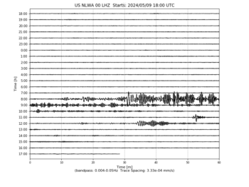
-
US/OGNE Ogallala, Nebraska, USA 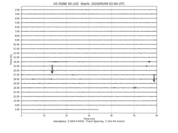
-
US/OXF Oxford, Mississippi, USA 
-
US/PKME Peaks-Kenny State Park, Maine, USA 
-
US/RLMT Red Lodge, Montana, USA 
-
US/SCIA State Center, Iowa, USA 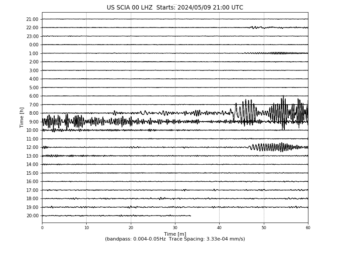
-
US/SDCO Great Sand Dunes National Park, Colorado, USA 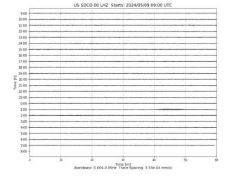
-
US/TPNV Topopah Spring, Nevada, USA 
-
US/TZTN Tazewell, Tennessee, USA 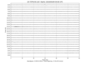
-
US/VBMS Vicksburg, Mississippi 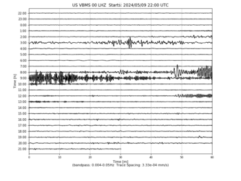
-
US/WMOK Wichita Mountains, Oklahoma, USA 
-
US/WRAK Wrangell Island, Southeastern Alaska, Alaska, USA 
-
US/WUAZ Wupatki, Arizona, USA 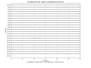
-
US/WVOR Wild Horse Valley, Oregon, USA 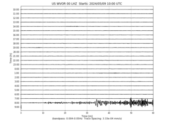
Dimensional Overlays of Each Earth Vibrating NOW

When you see EARTH and all as a myriad of different dimensions and timelines, with multiple universes within it, you will start to UNDERSTAND and REALIZE that Earth is not just one dimension, it’s a gazillion of them. Your OWN experience on this EARTH is your play that plays out for you. Your own dimension/timeline and you don’t get a higher vibrational one UNTIL YOU CHOOSE IT and EMBODY IT from within you. Instead of looking at the Earth as a the only reality as true, look at it as your dimensional version that you CREATED and HOLD THE VIBRATION for with every particle of you.
Continue reading “Dimensional Overlays of Each Earth Vibrating NOW”
Elon Musk Thinks Universal Income is Answer to Automation Taking Human Jobs
“There’s a pretty good chance we end up with a universal basic income, or something like that, due to automation,” said Musk. “I’m not sure what else one would do. That’s what I think would happen.”
The idea sounds great, and makes perfect sense in an emerging jobs landscape where automation in fast food, banks, customer service and, soon, deliveries are slowing erasing the incomes of vast swaths of middle and low-income U.S. citizens.
Continue reading here.
Sun Operating at Half-Power. Not What We Think It Is.
The Sun Is not what we have been told : (This will Blow Your Mind)
Weary Starseed Human Gets More Insights and Shares Them With You
 Earlier today someone on my facebook feed posted the question, “What if life is really like the movie The Truman Show”? Interesting question – one I have asked myself. Later this evening, as I watched a video on Tesla, a clip from The Truman Show was presented, making the comparison that our Reality is a giant illusion just as presented in the movie. I had also heard today that Antartica is an illusion but a further explanation was not forthcoming, so naturally I was intrigued to learn more. The Universe helped me with this.
Later in the evening I tried accessing Antarctica on google maps with the “earth image” option. However doing so I was told the entire continent has no images for me to zoom in on. Universe wasn’t done yet helping me out. If that weren’t enough, a friend of mine just “happened” to inform me a brief time later that viewing Antartica on google earth, when viewed from underneath or the bottom of the earth, you cannot see the rest of the earth.
When the Universe speaks to me in duplicate or triple, I know to pay attention – especially when it is combined with numerical patterns, which today was INSANE with them. 111, 1122, 1211, 311, 911, 1111 – you name it folks I have been seeing the #11 everywhere I look and today was off the charts. Also had a paranormal experience that we refer to as “ding dong ding dong”.
I am going to risk my reputation (as though I have one – LOL) and say the following. Well wait, let me first quote Tesla instead then I will give you my theory of what’s going to happen with these incoming energies, especially the one expected to hit within the next 6-7 days.
NIKOLA TESLA: “Earth is a realm, it is not a planet. It is not an object, therefore, it has no edge. Earth would be more easily defined as a system environment. Earth is also a machine, it is a Tesla coil. The sun and moon are powered wirelessly with the electromagnetic field (the Aether). This field also suspends the celestial spheres with electo-magnetic levitation. Electromag levitation disproves gravity because the only force you need to counter is the electromagnetic force, not gravity. The stars are attached to the FIRMAMENT.”
Makes you question your reality doesn’t it? I know when I have watched the skies, for years I have felt I am inside of some dome, a part of some experiment, and the stars and planets are not at the distance NASA and mainstream scientists claim. That intuitive feeling (of which I have a Phd in) has lead me to others who share the same pov – only these folks back up things with real science and awesome, thought-provoking questions.
The “veil” between dimensions has been weakening. Both science and spirituality tells us that. That is why we are seeing more “strange” things – unicorns, dragons, even the object Nibiru. UFO sightings are off the charts as well – begging the question: are some of them, perhaps most, dimensional as well? Heck, a friend of mine insists she and her friend saw a werewolf this past summer. She is not one to lie much less exaggerate. All previous examples I believe are dimensional objects that we are finally being privy to seeing because of this weakening. Each energetic wave, or pulse, whatever you wish to call it, weakens the energy grid between the dimensions. Those who are more “awake”, thus operating at a different vibrational frequency from those who are still in slumberland, are more likely to have such experiences. Speaking for myself, the more I have expanded my mind, the more out-of-the-norm experiences I have had.
So without further ado, do you want to know what I think is going to happen with this incoming blast of plasma energy? The big one? The mother of all energy blasts that has even system scientists worried?
The grid is gonna collapse and we’re gonna see the truth of where we are.
What say you fellow travelers?
Heliplots Update for 12/17/16 7:02 UTC (11:02 PST)
Heliplots
These data update automatically every 30 minutes
Last update: December 17, 2016 07:02:33 UTC
Seismograms may take several moments to load. Click on a plot to see larger image.
-
CU/ANWB Willy Bob, Antigua and Barbuda -
CU/BBGH Gun Hill, Barbados -
CU/BCIP Isla Barro Colorado, Panama -
CU/GRGR Grenville, Grenada -
CU/GRTK Grand Turk, Turks and Caicos Islands -
CU/GTBY Guantanamo Bay, Cuba -
CU/MTDJ Mount Denham, Jamaica -
CU/SDDR Presa de Sabenta, Dominican Republic -
CU/TGUH Tegucigalpa, Honduras -
IC/BJT Baijiatuan, Beijing, China -
IC/ENH Enshi, Hubei Province, China -
IC/HIA Hailar, Neimenggu Autonomous Region, China -
IC/KMI Kunming, Yunnan Province, China -
IC/LSA Tibet, China -
IC/MDJ Mudanjiang, Heilongjiang Province, China -
IC/QIZ Qiongzhong, Hainan Province, China -
IC/SSE Shanghai, China -
IC/WMQ Urumqi, Xinjiang Province, China -
IC/XAN Xi’an, China -
IU/ADK Adak, Aleutian Islands, Alaska -
IU/AFI Afiamalu, Samoa -
IU/ANMO Albuquerque, New Mexico, USA -
IU/ANTO Ankara, Turkey -
IU/BBSR Bermuda Institute of Ocean Sciences, St George’s Bermuda -
IU/BILL Bilibino, Russia -
IU/CASY Casey, Antarctica -
IU/CCM Cathedral Cave, Missouri, USA -
IU/CHTO Chiang Mai, Thailand -
IU/COLA College Outpost, Alaska, USA -
IU/COR Corvallis, Oregon, USA -
IU/CTAO Charters Towers, Australia -
IU/DAV Davao, Philippines -
IU/DWPF Disney Wilderness Preserve, Florida, USA -
IU/FUNA Funafuti, Tuvalu -
IU/FURI Mt. Furi, Ethiopia -
IU/GNI Garni, Armenia -
IU/GRFO Grafenberg, Germany -
IU/GUMO Guam, Mariana Islands -
IU/HKT Hockley, Texas -
IU/HNR Honiara, Solomon Islands -
IU/HRV Adam Dziewonski Observatory (Oak Ridge), Massachusetts, USA -
IU/INCN Inchon, Republic of Korea -
IU/JOHN Johnston Island, USA -
IU/KBL Kabul, Afghanistan -
IU/KBS Ny-Alesund, Spitzbergen, Norway -
IU/KEV Kevo, Finland -
IU/KIEV Kiev, Ukraine -
IU/KIP Kipapa, Hawaii, USA -
IU/KMBO Kilima Mbogo, Kenya -
IU/KNTN Kanton, Kiritibati -
IU/KONO Kongsberg, Norway -
IU/KOWA Kowa, Mali -
IU/LCO Las Campanas Astronomical Observatory, Chile -
IU/LSZ Lusaka, Zambia -
IU/LVC Limon Verde, Chile -
IU/MA2 Magadan, Russia -
IU/MACI Morro de la Arena, Canary Islands -
IU/MAJO Matsushiro, Japan -
IU/MAKZ Makanchi, Kazakhstan -
IU/MBWA Marble Bar, Western Australia -
IU/MIDW Midway Island, USA -
IU/MSKU Masuku, Gabon -
IU/NWAO Narrogin, Australia -
IU/OTAV Otavalo, Ecuador -
IU/PAB San Pablo, Spain -
IU/PAYG Puerto Ayora, Galapagos Islands -
IU/PET Petropavlovsk, Russia -
IU/PMG Port Moresby, New Guinea -
IU/PMSA Palmer Station, Antarctica -
IU/POHA Pohakuloa, Hawaii, USA -
IU/PTCN Pitcairn Island, South Pacific -
IU/PTGA Pitinga, Brazil -
IU/QSPA South Pole Remote Earth Science Observatory (Quiet Zone) -
IU/RAO Raoul, Kermadec Islands -
IU/RAR Rarotonga, Cook Islands -
IU/RCBR Riachuelo, Brazil -
IU/RSSD Black Hills, South Dakota, USA -
IU/SAML Samuel, Brazil -
IU/SBA Scott Base, Antarctica -
IU/SDV Santo Domingo, Venezuela -
IU/SFJD Sondre Stromfjord, Greenland -
IU/SJG San Juan, Puerto Rico -
IU/SLBS Sierra la Laguna Baja California Sur, Mexico -
IU/SNZO South Karori, New Zealand -
IU/SSPA Standing Stone, Pennsylvania -
IU/TARA Tarawa Island, Republic of Kiribati -
IU/TATO Taipei, Taiwan -
IU/TEIG Tepich, Yucatan, Mexico -
IU/TIXI Tiksi, Russia -
IU/TRIS Tristan da Cunha -
IU/TRQA Tornquist, Argentina -
IU/TSUM Tsumeb, Namibia -
IU/TUC Tucson, Arizona -
IU/ULN Ulaanbaatar, Mongolia -
IU/WAKE Wake Island -
IU/WCI Wyandotte Cave, Indiana, USA -
IU/WVT Waverly, Tennessee, USA -
IU/XMAS Kiritimati Island, Republic of Kiribati -
IU/YAK Yakutsk, Russia -
IU/YSS Yuzhno Sakhalinsk, Russia -
US/AAM Ann Arbor, Michigan, USA -
US/ACSO Alum Creek State Park, Ohio, USA -
US/AGMN Agassiz National Wildlife Refuge, Minnesota, USA -
US/AHID Auburn Hatchery, Idaho, USA -
US/AMTX Amarillo, Texas, USA -
US/BINY Binghamton, New York, USA -
US/BLA Blacksburg, Virginia, USA -
US/BMO Blue Mountains Array (Baker), Oregon, USA -
US/BOZ Bozeman, Montana, USA -
US/BRAL Brewton, Alabama, USA -
US/BW06 Boulder Array Site 6 (Pinedale Array Site 6), Wyoming, USA -
US/CBKS Cedar Bluff, Kansas, USA -
US/CBN Corbin (Fredericksburg Observatory), Virginia, USA -
US/CNNC Cliffs of the Neuse, North Carolina, USA -
US/COWI Conover, Wisconsin, USA -
US/DGMT Dagmar, Montana, USA -
US/DUG Dugway, Tooele County, Utah, USA -
US/ECSD EROS Data Center, Sioux Falls, South Dakota, USA -
US/EGAK Eagle, Central Alaska, Alaska, USA -
US/EGMT Eagleton, Montana, USA -
US/ELK Elko, Nevada, USA -
US/ERPA Erie, Pennsylvania, USA -
US/EYMN Ely, Minnesota, USA -
US/GLMI Grayling, Michigan, USA -
US/GOGA Godfrey, Georgia, USA -
US/HAWA Hanford, Washington, USA -
US/HDIL Hopedale, Illinois, USA -
US/HLID Hailey, Idaho, USA -
US/HWUT Hardware Ranch, Cache County, Utah, USA -
US/ISCO Idaho Springs, Colorado, USA -
US/JCT Junction, Texas, USA -
US/JFWS Jewell Farm, Wisconsin, USA -
US/KSU1 Kansas State University–Konza Prairie, Kansas, USA -
US/KVTX Kingsville, Texas, USA -
US/LAO LASA Array, Montana, USA -
US/LBNH Lisbon, New Hampshire, USA -
US/LKWY Lake (Yellowstone–Lake), Yellowstone National Park, Wyoming -
US/LONY Lake Ozonia, New York, USA -
US/LRAL Lakeview Retreat, Alabama, USA -
US/MCWV Mont Chateau, West Virginia, USA -
US/MIAR Mount Ida, Arkansas, USA -
US/MNTX Cornudas Mountains, Texas, USA -
US/MSO Missoula, Montana, USA -
US/MVCO Mesa Verde, Colorado, USA -
US/NATX Nacogdoches, Texas, USA -
US/NEW Newport, Washington, USA -
US/NHSC New Hope, South Carolina, USA -
US/NLWA Neilton Lookout, Washington, USA -
US/OGNE Ogallala, Nebraska, USA -
US/OXF Oxford, Mississippi, USA -
US/PKME Peaks-Kenny State Park, Maine, USA -
US/RLMT Red Lodge, Montana, USA -
US/SCIA State Center, Iowa, USA -
US/SDCO Great Sand Dunes National Park, Colorado, USA -
US/TPNV Topopah Spring, Nevada, USA -
US/TZTN Tazewell, Tennessee, USA -
US/VBMS Vicksburg, Mississippi -
US/WMOK Wichita Mountains, Oklahoma, USA -
US/WRAK Wrangell Island, Southeastern Alaska, Alaska, USA -
US/WUAZ Wupatki, Arizona, USA -
US/WVOR Wild Horse Valley, Oregon, USA
Busted – Cops Caught Giving Fake News To Mainstream Media Who When Report It As Fact

By Matt Agorist
Santa Maria, CA — As the war on alleged ‘fake news’ wages on, the establishment is losing horribly. All the corporate media and government’s war on fake news has done is serve to expose the most guilty — the corporate media and the government. From the Gulf of Tonkin to Weapons of Mass Destruction — corporate media and government have colluded to perpetuate the death and suffering of millions.
Government constructed lies spread by their mouthpieces in the media isn’t solely limited to the Pentagon and their blowhards. As a new report from the Guardian shows, fake news is also put out by police departments.
When Santa Maria police chief Ralph Martin was caught last week in a conspiracy to deceive the press and the public through the release of a fictitious news story, he was unapologetic.
“It was a moral and ethical decision, and I stand by it,” Martin said. “I am keenly aware and sensitive to the community and the media. I also had 21 bodies lying in the city in the last 15 months.”
Continue reading here.